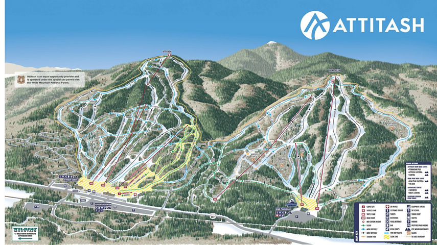
Trail Maps
This map shows the entirety of our terrain including trails, lifts, glades, terrain parks and slow-skiing areas across Attitash & Bear Peak.
Winter Trail Map , opens in a new window
ATTITASH SIDE
Our original mountain that opened in January of 1965 with only a handful of the trails we have today. It's seen many improvements and expansions over the years but the soul of the mountain has remained the same...classic New England cruisers.
BEAR PEAK SIDE
In the mid-1990s Bear Peak came into the picture. This dramatically increased the available skiing & riding acreage along with the installation of a high-speed summit quad chairlift. Offering a different blend of terrain from the Attitash side, you can find wider intermediate trails, open glades and quality race slopes.
Launching Winter 23/24
MEET THE NEW MY EPIC APP WITH MOBILE PASS , opens in a new window
Take an Epic expert with you wherever you go on the mountain. My Epic app provides you:
- Mobile Pass & Lift ticket
- Interactive trail maps, with trail and grooming status
- Real-time weather, snow totals and mountain cams
- Your on-mountain GPS location and stat tracking
- Resort updates and safety information
- And more!